This represents an engineering oversight that introduces avoidable risks, which ultimately leads to a “more expensive cost” in the long term—in the form of remedial work expenses, construction delays, and damage to the project’s reputation. The critical question, then, is: What is Soil Investigation? What are its key procedures? And why should “every project” consider this an indispensable, fundamental step? Let’s explore the answers in this article.
Table of Contents
What is Soil Investigation?
What are the risks of skipping soil investigation?
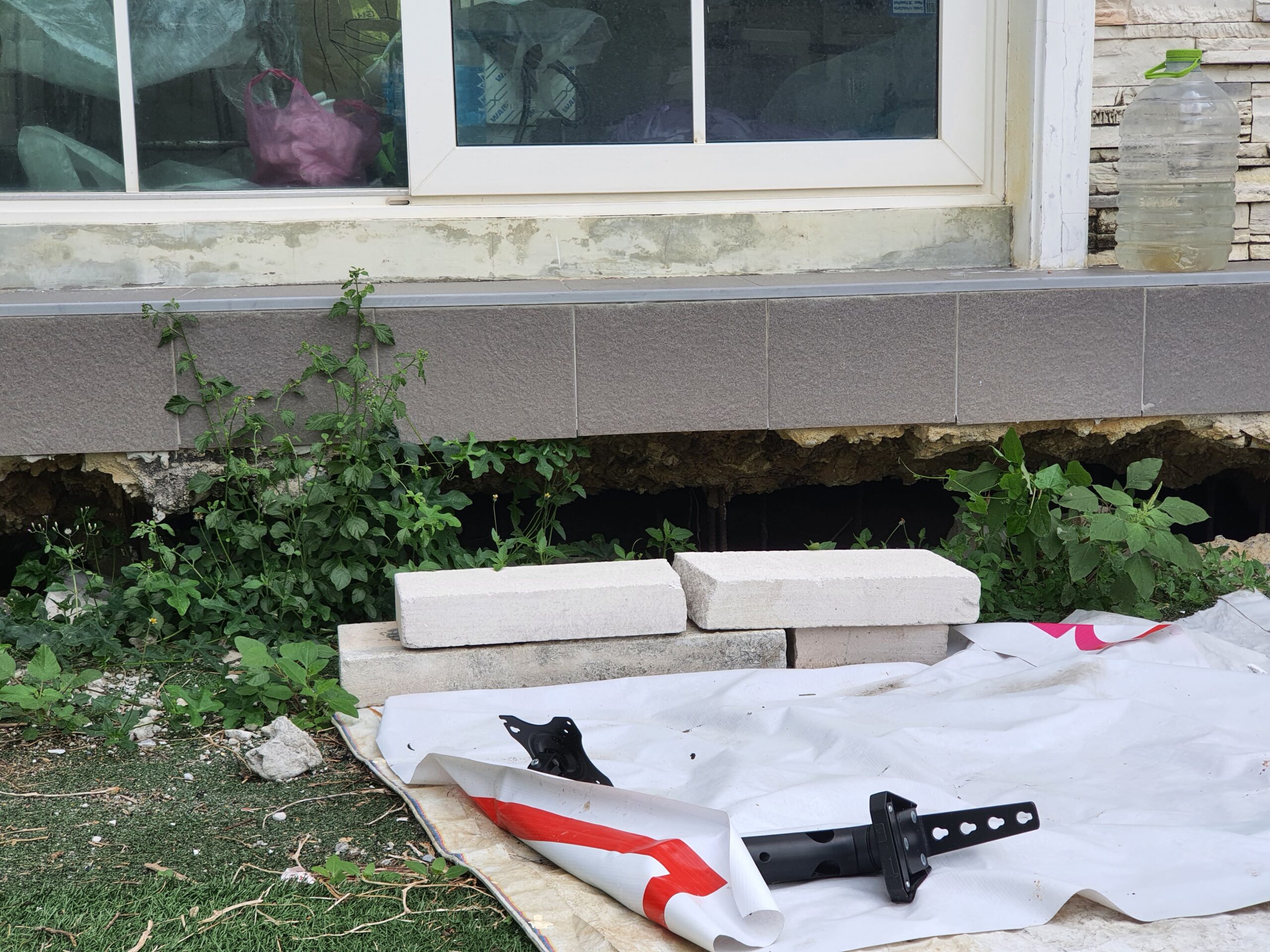

An Example picture of settlement due from residentials estate in bangkok.
- Risk of Foundation Failure
- Reduced Structural Stability
- Increased Remedial Costs and Construction Time
- Safety and Legal Liability
Field Methods You Should Know
Method | Principle (Summary) | Advantage | Limitations/ Disadvantage | Typical Use Cases |
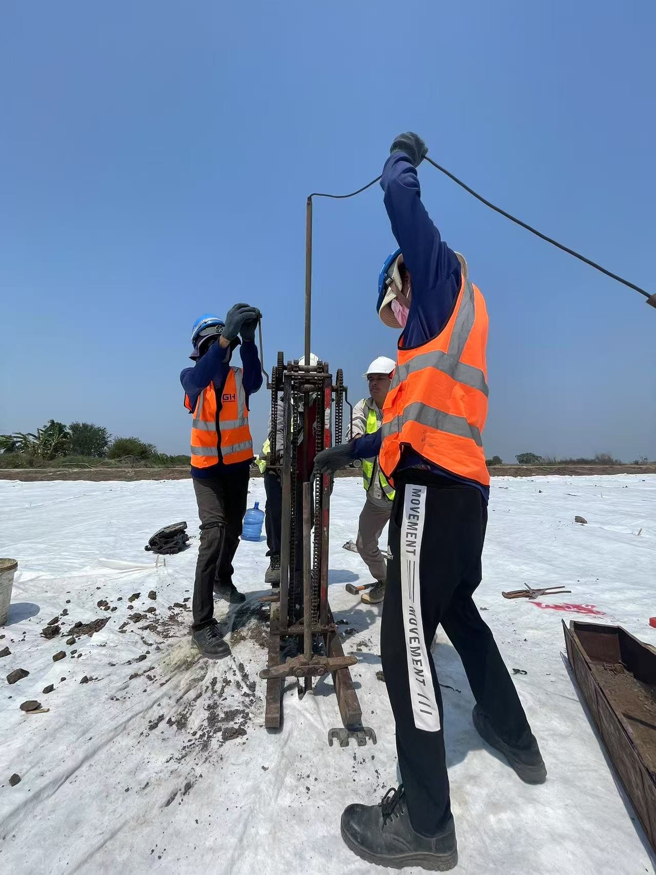
Soil Boring + Standard Penetration Test (SPT) | Uses Rotary Drilling or Percussion Drilling. At the required depth, a split-spoon sampler is driven into the soil to measure the penetration resistance (N-value) and collect soil samples for laboratory testing. | – Immediate soil classification can be performed in the field. – Obtains actual soil samples (Disturbed / Undisturbed). – Provides data for Bearing Capacity assessment and samples for comprehensive lab testing. – Applicable to all soil types. – A globally recognized standard method (ASTM D1586). – Low cost and can be integrated with the drilling process. | – Time consuming – Provides point data only (non-continuous profile). – Accuracy is dependent on the driller and equipment condition. | General foundations, buildings, roads, dams, and most types of structural design work. |
Cone Penetration Test (CPT) | pushed into the soil at a constant speed (20 mm/s). It measures Cone Resistance and Sleeve Friction which can be correlated to estimate the SPT N-value. | – Provides continuous data throughout the depth. – Enables detailed analysis of soil type and density/consistency. – Fast and time-saving. – Cost-effective when performed in large quantities compared to standard soil boring. | – Does not obtain actual soil samples. – Not usable in soils containing gravel or boulders – Equipment is relatively expensive. | Suitable for fine-grained to sandy soils; metro and tunnel projects, offshore investigations, and detailed foundation design. |
Vane Shear Test (VST) | A rotating vane is inserted into soft clay to measure the Undrained Shear Strength | – Simple, fast, and inexpensive to perform. – Highly suitable for soft cohesive clays. | – Not suitable for stiff clays (typically N-value > 12) – Test results are sensitive to soil disturbance during insertion, which may lead to misleading results. | Embankments, dams, and foundations built on soft clay deposits. |
Engineering Summary of Field Investigation Methods
- SPT is the global baseline for most projects: you get N-values and real samples for lab testing.

Example picture of SPT from Constro Facilitator
- CPT provide high-resolution continuous profiles—excellent for underground works, metros, offshore, or where stratigraphy changes quickly.
Example picture of CPT method
- VST is the go-to for soft clay Su mapping.

Example picture of VST method from STATS Australia
Critical Planning Guidelines for Field Soil Investigation
Determining the Optimal Number, Spacing, and Depth of Boreholes
Number and Spacing of Boreholes
Type of Structures
Type of structure | Recommended Borehole Spacing (meters) | Engineering Rationale |
Small Residential Buildings (1–2 Storeys) | 30 – 60 | The structure has a low weight and a shallow foundation. Frequent drilling is often unnecessary. Spacing can be extended up to $60text{ m}$ if the soil is uniform, but a minimum of two boreholes is required to confirm soil continuity across the site. |
Medium-Sized Buildings (5–10 Storeys) | 20 – 30 | Applied loads begin to increase, leading to a higher potential for noticeable settlement. Closer spacing helps detect variations in the soil strata, such as intermittent sand layers or soft zones, ensuring consistency across the site. |
High-Rise Buildings (Over 10 Storeys) | 10 – 20 | High structural loads typically necessitate deep foundations (e.g., large piles). Detailed information on the Bearing Stratum (the soil or rock layer strong enough to support the structure) is essential to prevent discrepancies in the actual bearing capacity of individual piles. |
Roads / Highways | 200 – 500 | These are long, linear structures with evenly distributed loads. Increased spacing helps reduce cost. The focus is on adding boreholes only at critical structures (e.g., bridges, underpasses) or where topography changes significantly. |
Bridges / Piers / Viaducts | 1–2 boreholes per pier location | Each pier or abutment sustains a large, concentrated point load. Investigation must be performed directly at each foundation location to precisely determine the supporting soil properties. |
Dams / Earth Embankments | 50 – 100 | These are long structures where the continuity of the foundation soil is crucial. Investigation must check the alignment for potential fault lines, discontinuities, or soft soil inclusions that could cause seepage or differential settlement and failure. |
Large Industrial Plants / Complexes | 50 – 100 | These sites have large areas and often feature unevenly distributed loads (e.g., heavy machinery areas, liquid storage tanks). The site should be divided into zones, ensuring the investigation covers all critical loading areas comprehensively. |
Soil Variability
- If the site’s soil strata are relatively uniform, the number of boreholes can be reduced, and the spacing increased without compromising data accuracy, thus saving time and cost.
- Conversely, if the soil is complex or rapidly changing, a higher density of boreholes is required to obtain sufficiently detailed data for reliable analysis and foundation design.
Purpose of Investigation
Preliminary Exploration
Detailed Design
Depth of Boreholes
- Obtain data for all soil layers that will be affected by the foundation loads.
- Penetrate deep enough to identify any underlying soft or loose soil strata that could cause short- or long-term settlement.
- Roads or Small-to-Medium Buildings: Investigation depths typically range from 10 to 30 meters, or until a hard stratum (SPT N-value $\ge 50$) is encountered for two to three consecutive intervals.
- Large Structures (High-rises, Bridges, Piers): Due to extremely high loads, drilling may be required to depths of 30 to over 60 meters, or until a competent bedrock layer capable of supporting the structure is reached.
- Reaching an SPT N-value $\ge 50$ for three consecutive intervals (or equivalent resistance).
- Encountering hard stratum or weathered rock where standard casing cannot be driven further.
- It is crucial to penetrate the first hard layer by an additional 3 to 5 meters (or 2 to 3 intervals) to confirm it is a true bearing layer and not just a thin, hard crust.
Conclusion
Further Reading
- คู่มือวิศวกรรมปฐพีฐานราก (Foundation Engineering Handbook) – ดร.พัลลภ วิสุทธิ์เมธานุกูล
- “ความรู้ทั่วไปในการเจาะสำรวจชั้นดิน” “วิธีการเจาะสำรวจดิน” – นายยงยุทธ ศรีเมฆารัตน์
- เทคนิคก่อสร้าง – ผศ. วิทวัส สิทธิกูล (2557)
Follow us on other channels
Facebook: Facebook Profile
Linkedin: Linkedin Profile